Application and evaluation of a GPS multi-antenna system for dam
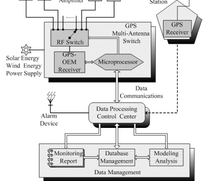
deformation monitoring Xiufeng He, Guang Yang, Xiaoli Ding, and Yongqi Chen College of Civil Engineering, Hohai University, Nanjing, China Department of Land Surveying and Geo-Informatics, the Hong Kong Polytechnic University, Hong Kong Abstract This paper describes GPS multi-antenna device (one GPS receiver links multiple antennas) developed by authors, and the experimental results are presented. GPS has already proven to be an efficient tool for monitoring dam deformations and stability of high-risk slopes. It offers greater accuracy than other surveying techniques. However, GPS has its disadvantages when employing for slope and dam monitoring. The major drawback has been high cost due to large-scale GPS deployments are required in monitoring sites. The conventional GPS monitoring methods, where a permanent GPS receiver must be located at each point, have significant limitations of the cost. A new approach that a single GPS receiver links multiple antennas mounted at the monitoring points, has been employed to solve these problems in this paper. A dedicated switching device has been developed by authors for this approach. Field testing results show that the dedicated switching device for GPS multi-antenna system has excellent performances. Post-processing positioning accuracy is around 1–2 mm for the deformation monitoring of the Xiaolangdi dam on the Yellow River.
|
|||||||||||||||||||||||||||||||||||||||||||||||||||||


